
Jonesboro → Village Creek State Park
Jonesboro to Village Creek State Park, the hilliest day of the week.
One page with the day at a glance. Print it or save it to your phone.
Onto the ridge
The first day is the one that surprises people. Crowley's Ridge is not the Ozarks, but it is not flat either, and the gravel on top of it rolls hard. Start steady, drink early, and give yourself room at the second aid station, because the stretch after it is the longest unsupported run of the week.
Accommodations
Village Creek State Park is roughly 10 miles outside of Wynne, which hosts few lodging options. Camping at the venue is included, and the closest hotels are in Wynne.
Venue address: 201 County Road 754, Wynne, AR 72396
| Property | Distance | Book |
|---|---|---|
| Nationwide 9 Inn Wynne | 10 miles from the campground | Visit site → |
| Days Inn & Suites by Wyndham – Wynne | 10 miles from the campground | Visit site → |
For RVs, if you need hookups: full hookups on site.
Schedule
Everything with a time on it. The start window is 8:00 AM program, 8:30 AM start.
| Time | What | Where | Who |
|---|---|---|---|
| 6:00–8:00 AM | Coffee & Breakfast | Jonesboro | Centennial Bank |
| 6:00–7:00 AM | Late packet pickup | Jonesboro | — |
| 6:00–8:00 AM | Parking attendants on site | A-State Stadium | — |
| 8:00 AM | Start line program | A-State Stadium | Bobby Finster and Mike Spivey |
| 8:30 AM | Ride start | A-State Stadium | — |
| 12:00 PM | Finish line opens | Village Creek State Park | — |
| 3:00, 4:00 and 5:00 PM | Golf cart tours of the park, one hour each | Village Creek SP | — |
| 5:00 PM | Ridge to River, first screening | Village Creek SP | AWAL Productions |
| 5:30–7:00 PM | Dinner | Village Creek SP | Hogapalooza |
| 6:30 PM | Ridge to River, second screening | Village Creek SP | AWAL Productions |
| 9:00 PM | Quiet hours | — | — |
Map and profile
Markers, aid and cutoffs
| Mile | Marker | Type | Detail |
|---|---|---|---|
| 0 | A-State Stadium | Start | |
| 24.6 | Big O's BBQ | Aid station | 9:00 AM–12:30 PM. Aid 1. A partner, open for the Graveler. |
| 40.4 | Arkansas State Veterans Cemetery | Site | Right before Aid 2, and worth the stop. A beautiful cemetery and a tribute to those who have served our state and country. |
| 41.6 | Smith Farm, Birdeye | Aid station | 10:00 AM–3:30 PM, cutoff. Aid 2. Archery 10:00–2:00, sandwich bar 10:00–3:00. |
| 71.2 | Village Creek State Park | Finish |
Village Creek State Park
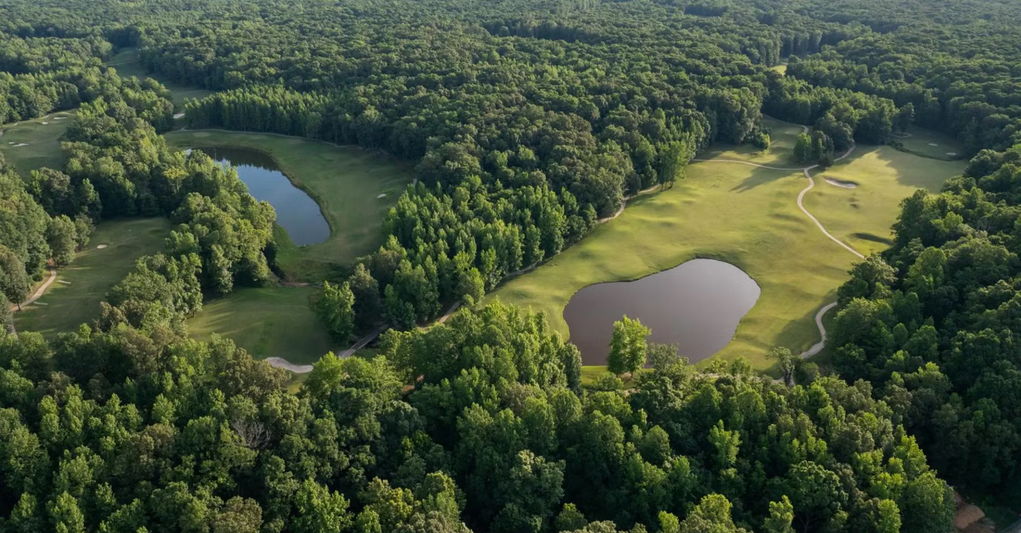
Hardwood on the eastern edge of Crowley's Ridge, and the first night the field starts talking to itself.
Crowley's Ridge is an erosional remnant. The theory is that it was once an island between the Mississippi and the Ohio; when those rivers moved, the ridge survived while everything around it eroded flat and filled with alluvium. Then wind-blown glacial silt, called loess, settled on top and stayed, while it washed off the lowlands. In places that cap is fifty feet deep.
The ridge runs roughly a hundred and fifty to two hundred miles, from southeastern Missouri down to Helena, and stands about two hundred and fifty feet above the Delta. Deep, well-drained soil and steep ravines let beech, sugar maple and tuliptree grow here, which is why the woods you are camping in look more like Tennessee than like the country you rode through to get here.
It is also why Tuesday carries 2,331 of the week's 7,561 feet.
- Address
- 201 County Road 754, Wynne, AR 72396
- Walkable
- The park is genuinely isolated and there is no store, fuel or pharmacy short of Wynne, about six miles away. Bring what you need with you.
- Quiet hours
- 9:00 PM
- Cell service
- Expect no usable signal at the campground on any carrier. There is Wi-Fi at the visitor center while it is open. This is the most disconnected night of the week, and most people are pretty happy about it.
What is here
- Nearly seven thousand acres, the second-largest state park in Arkansas
- Visitor center with a gift shop and a museum on the ridge and the Trail of Tears, open 8:00 AM to 5:00 PM
- Two lakes, Dunn and Austell
- Thirty-three miles of trails
If you have an hour
- The Military Road Trail — About two and a quarter miles. Arkansas State Parks calls what it follows the most intact segment of the removal trail, and a dramatic sunken remnant of it. The road is the Memphis to Little Rock Road, finished in 1829. The Cherokee Bell detachment came through here, and so did Choctaw, Muscogee and Chickasaw removals. A man named William Strong lived on land now inside the park and ran the store that was the second ration depot supplying those parties.
- The visitor center museum — Open until five.
- Lake Dunn — If you want to sit still next to water.
Wynne
A working town running one of Tuesday's aid stations.
What it is now
Wynne calls itself the City with a Smile. It is the seat of Cross County, and it started in 1882 when a derailed train left a boxcar beside the new railroad and the boxcar became Wynne Station. Mueller Streamline makes copper tube and fittings here and expanded in 2025. Around it are rice, soybeans, wheat, cotton and corn, a school district and a community college campus.
You are riding through rather than staying, and the aid station is theirs.
After you finish
Everything on the schedule from the moment the finish line opens.
| Time | What | Where | Who |
|---|---|---|---|
| 3:00, 4:00 and 5:00 PM | Golf cart tours of the park, one hour each | Village Creek SP | — |
| 5:00 PM | Ridge to River, first screening | Village Creek SP | AWAL Productions |
| 5:30–7:00 PM | Dinner | Village Creek SP | Hogapalooza |
| 6:30 PM | Ridge to River, second screening | Village Creek SP | AWAL Productions |
| 9:00 PM | Quiet hours | — | — |
Weather and medical
We ride in rain. If lightning is near we shelter, and every host location has a designated indoor space for weather that turns serious.
- Medical
- UAMS is on site. They can assist immediately and connect you to any local hospital or emergency services as necessary.